Garmin ECHOMAP UHD 74sv With GT56UHD-TM Transducer (Open Box)
SONAR SUPPORT
This chartplotter supports a variety of Garmin transducers (sold separately), including the Panoptix LiveScope™ scanning sonar system, which lets you see all around your boat in real time.
VIVID COLOR PALETTES
High-contrast vivid scanning sonar color palettes make it easier than ever to distinguish targets and structure.
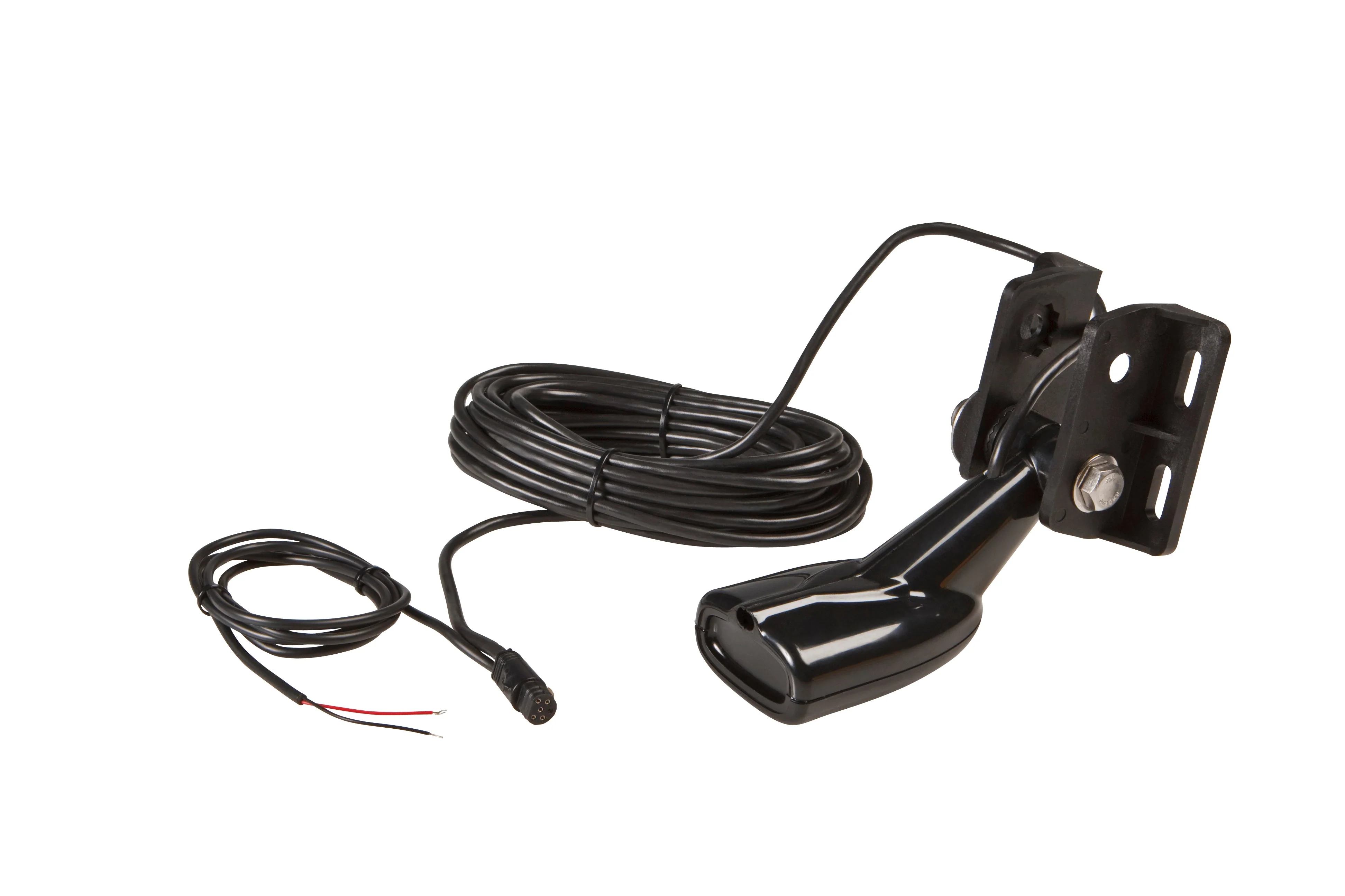
OPTIONAL TRANSDUCER BUNDLE
Select the transducer bundle to add a GT56 transducer for Garmin CHIRP traditional sonar and Ultra High-Definition ClearVü and SideVü scanning sonars. With three scanning sonar frequencies and 20% greater range for our UHD SideVü sonar, you’ll get top performance at all depths.
PRELOADED CHARTS
Experience unparalleled coverage and detail with preloaded BlueChart® g3 coastal charts featuring integrated Navionics® data. Charts cover the coastal U.S., including the East and West coasts, Gulf of Mexico and the U.S. and Canadian sides of the Great Lakes.
QUICKDRAW CONTOURS
Create personalized fishing maps on-screen with 1’ contours. Keep the data to yourself, or share it with the Quickdraw Community on the Garmin Connect™ app3.
Original: $1,099.99
-65%$1,099.99
$385.00Product Information
Product Information
Shipping & Returns
Shipping & Returns
Description
SONAR SUPPORT
This chartplotter supports a variety of Garmin transducers (sold separately), including the Panoptix LiveScope™ scanning sonar system, which lets you see all around your boat in real time.
VIVID COLOR PALETTES
High-contrast vivid scanning sonar color palettes make it easier than ever to distinguish targets and structure.
OPTIONAL TRANSDUCER BUNDLE
Select the transducer bundle to add a GT56 transducer for Garmin CHIRP traditional sonar and Ultra High-Definition ClearVü and SideVü scanning sonars. With three scanning sonar frequencies and 20% greater range for our UHD SideVü sonar, you’ll get top performance at all depths.
PRELOADED CHARTS
Experience unparalleled coverage and detail with preloaded BlueChart® g3 coastal charts featuring integrated Navionics® data. Charts cover the coastal U.S., including the East and West coasts, Gulf of Mexico and the U.S. and Canadian sides of the Great Lakes.
QUICKDRAW CONTOURS
Create personalized fishing maps on-screen with 1’ contours. Keep the data to yourself, or share it with the Quickdraw Community on the Garmin Connect™ app3.