Garmin GPSMAP 8612xsv With Mapping and Sonar
In the Box
- GPSMAP 8612xsv
- Power cable
- NMEA 2000® drop cable
- NMEA 2000 T-connector
- Bail mount with knobs
- Flush mount kit
- Sun cover
- Trim piece snap covers
- Documentation
SERIOUS ANGLERS, CRUISERS, SAILORS AND SAIL RACERS DEMAND SERIOUS EQUIPMENT
The easy-to-use, easy-to-install chartplotter/sonar combo delivers MFD performance in a combo-size package.
Get wider viewing angles and superior clarity on the touchscreen with a full HD in-plane switching (IPS) display.
Navigate confidently with built-in Garmin Navionics+™ inland and coastal mapping1.
Easily build your marine system using the best of network connectivity.
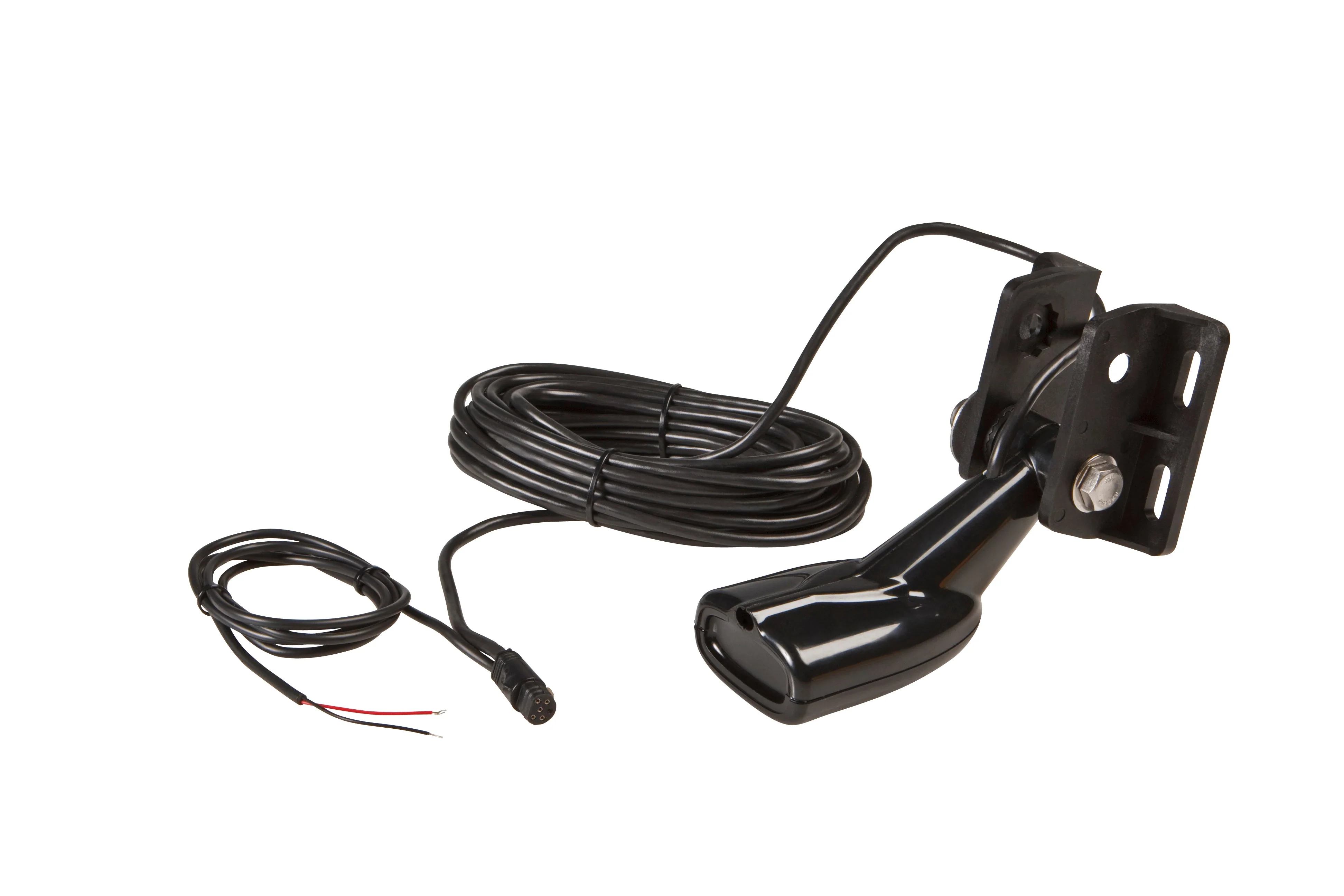
See below and around your boat with built-in sonar capabilities (transducers sold separately).
From ANT® technology to Wi-Fi® networking, there are countless ways to connect to your system.
With SmartMode™ station controls, everything is designed to give you quick, one-touch access to the information you need.
HD IPS TOUCHSCREEN
Available in sizes from 10” to 24”, this display offers wider viewing angles, superior clarity and sunlight readability, even with polarized sunglasses.
SIMPLE, ATTRACTIVE MOUNTING OPTIONS
You can install multiple displays, either flat mounted edge-to-edge for a sleek glass helm look or mounted flush — creating a stunning helm.
GRID™ 20 REMOTE CONTROL
The optional, easy-to-use GRID 20 remote input device provides intuitive remote access and control of your entire Garmin marine system.
TRADITIONAL AND SCANNING SONAR SUPPORT
Get built-in support for 1-kW Dual-Channel CHIRP traditional sonar for superior target separation and ClearVü and SideVü scanning sonars to see up to 1,000’ below and around your boat at 260 kHz (requires transducer, sold separately).
LIVE SONAR SUPPORT
Pair your chartplotter with Garmin live sonar options (transducer sold separately) to see all around your boat in real time.
GARMIN SAILASSIST™ SAILING FEATURES
View laylines, race start line guidance, enhanced wind rose, heading and course-over-ground lines, true wind data fields and tide/current/time slider, wind angle, set and drift, wind speed, polars and more.
PRELOADED MAPPING
Experience unparalleled coverage and detail with built-in Garmin Navionics+™ integrated coastal and inland mapping that includes Auto Guidance+™ technology3 and a 1-year subscription for downloadable daily updates and more on select chartplotters.
OPTIONAL CHARTS AND MAPS
Bring a fresh new look and feel to your chartplotter with optional upgrade to Garmin Navionics Vision+™ premium chart subscription, featuring downloadable high-resolution relief shading, satellite imagery, sonar imagery and more.
SAILING POLARS
Use the polar table to see key data, including how fast you should go at a certain wind angle and speed — so you know whether you need to adjust sail trim.
Original: $4,299.99
-65%$4,299.99
$1,505.00Product Information
Product Information
Shipping & Returns
Shipping & Returns
Description
In the Box
- GPSMAP 8612xsv
- Power cable
- NMEA 2000® drop cable
- NMEA 2000 T-connector
- Bail mount with knobs
- Flush mount kit
- Sun cover
- Trim piece snap covers
- Documentation
SERIOUS ANGLERS, CRUISERS, SAILORS AND SAIL RACERS DEMAND SERIOUS EQUIPMENT
The easy-to-use, easy-to-install chartplotter/sonar combo delivers MFD performance in a combo-size package.
Get wider viewing angles and superior clarity on the touchscreen with a full HD in-plane switching (IPS) display.
Navigate confidently with built-in Garmin Navionics+™ inland and coastal mapping1.
Easily build your marine system using the best of network connectivity.
See below and around your boat with built-in sonar capabilities (transducers sold separately).
From ANT® technology to Wi-Fi® networking, there are countless ways to connect to your system.
With SmartMode™ station controls, everything is designed to give you quick, one-touch access to the information you need.
HD IPS TOUCHSCREEN
Available in sizes from 10” to 24”, this display offers wider viewing angles, superior clarity and sunlight readability, even with polarized sunglasses.
SIMPLE, ATTRACTIVE MOUNTING OPTIONS
You can install multiple displays, either flat mounted edge-to-edge for a sleek glass helm look or mounted flush — creating a stunning helm.
GRID™ 20 REMOTE CONTROL
The optional, easy-to-use GRID 20 remote input device provides intuitive remote access and control of your entire Garmin marine system.
TRADITIONAL AND SCANNING SONAR SUPPORT
Get built-in support for 1-kW Dual-Channel CHIRP traditional sonar for superior target separation and ClearVü and SideVü scanning sonars to see up to 1,000’ below and around your boat at 260 kHz (requires transducer, sold separately).
LIVE SONAR SUPPORT
Pair your chartplotter with Garmin live sonar options (transducer sold separately) to see all around your boat in real time.
GARMIN SAILASSIST™ SAILING FEATURES
View laylines, race start line guidance, enhanced wind rose, heading and course-over-ground lines, true wind data fields and tide/current/time slider, wind angle, set and drift, wind speed, polars and more.
PRELOADED MAPPING
Experience unparalleled coverage and detail with built-in Garmin Navionics+™ integrated coastal and inland mapping that includes Auto Guidance+™ technology3 and a 1-year subscription for downloadable daily updates and more on select chartplotters.
OPTIONAL CHARTS AND MAPS
Bring a fresh new look and feel to your chartplotter with optional upgrade to Garmin Navionics Vision+™ premium chart subscription, featuring downloadable high-resolution relief shading, satellite imagery, sonar imagery and more.
SAILING POLARS
Use the polar table to see key data, including how fast you should go at a certain wind angle and speed — so you know whether you need to adjust sail trim.